Mile 23 Report
Pistol River SP north, south of Myers Creek
October 2, 2015
A few people: one windsurfer on beach , 4 walkers and a photographer.
Report Details
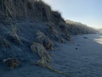
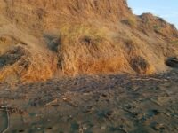
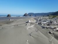
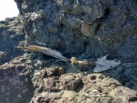
A few people: one windsurfer on beach , 4 walkers and a photographer. Driftline has small (1/2 inch) crustacean shells about, some kelp, a few mussels.Summer sand deposits have covered winter cut banks, new shallow embayment at north end. One dead pinniped, probably a seal, rather fresh , near Myers Creek.
Conditions
Temperature: 64 F. Cloud Cover: Sunny. Wind Velocity: Strong. Wind Direction: N. Tide Level: 7.5 feet.
Human Activities
Number of people: 6. Walking or running: 4. Photography: 1. Windsurfing: 1. Minor activity, no litter at all, four driftwood "forts" here and there.
Concerns
Vehicles
Notable Wildlife
Very few birds
Stranded Marine Mammals
Total stranded mammals: 1. Seal, about 7 ft. long, rather fresh based on lack of stench, skull stripped of flesh, two circular wounds. One near left shoulder, one on left upper flank about 8 inches diameter. Located 40 paces south of Myers Creek on sand.
Dead Fish or Invertebrates
No, a very few clumps of mussels
Driftline Content
Seaweeds and seagrass, Animal casings (e.g., crab, shrimp molt), Wood pieces.
Natural Changes
Summer sand deposits, but different patterns than usual eg large pool sea water in area normally well drained. Recent "supermoon tides" perhaps at work
Actions & Comments
I filed a Marine Mammal Stranding report.
All Mile 23 Reports
Mile 23
Pistol River SP north, south of Myers Creek
There was a lot of small plastic debris and natural tree debris along the tide line between Meyers Creek and a short distance south of the stacks.
Botermans
Mile 23
Pistol River SP north, south of Myers Creek
Steep newly cut foredunes and rocks more exposed because of winter waves scouring the beach.
Bob Harvey
Mile 23
Pistol River SP north, south of Myers Creek
The cave in one of the monoliths was accessible.
Bob Harvey
Mile 23
Pistol River SP north, south of Myers Creek
The tallest dunes (~10ft) are being eroded as they are each year.
Bob Harvey
Mile 23
Pistol River SP north, south of Myers Creek
Illegal ATV tracks recently made running from south to north and back again.
Bob Harvey
Mile 23
Pistol River SP north, south of Myers Creek
Parked here to walk Mile 22.
Lavenne22

