Mile 23 Report
Pistol River SP north, south of Myers Creek
October 12, 2018
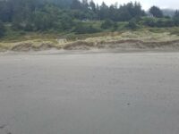
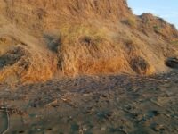
People enjoying Beach, foredunes stacked with summer sand from the northwest.
Report Details
People enjoying Beach, foredunes stacked with summer sand from the northwest. New signage along Highway 101 such as "no overnight parking", yellow safety location signs 183,184,185
Conditions
Temperature: 69 F. Wind Velocity: Moderate. Wind Direction: NW. Tide Level: 6.0 feet.
Human Activities
Number of people: 11. Number of dogs: 3. Walking or running: 7. Sitting: 4. It's all good ...
Concerns
Litter
Vehicles
Cars/trucks parking: 7. RVs/Buses parking: 1.
Notable Wildlife
About 100 gulls on the shore of Myers Creek
Driftline Content
Seaweeds and seagrass, Shells. 2 large clumps of mussels
New Development
None
Natural Changes
Nw winds have stacked sand against foredunes
Actions & Comments
Called Harris Beach S P to remove tire from below rescue sign 184


Report Images
Bob Harvey
CoastWatcher
All Mile 23 Reports
Mile 23
Pistol River SP north, south of Myers Creek
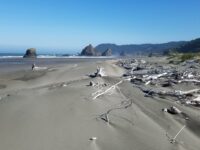
There was a lot of small plastic debris and natural tree debris along the tide line between Meyers Creek and a short distance south of the stacks.
Botermans
Mile 23
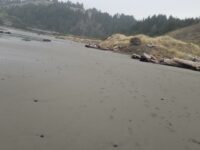
Pistol River SP north, south of Myers Creek
Steep newly cut foredunes and rocks more exposed because of winter waves scouring the beach.
Bob Harvey
Mile 23
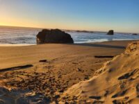
Pistol River SP north, south of Myers Creek
The cave in one of the monoliths was accessible.
Bob Harvey
Mile 23
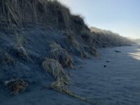
Pistol River SP north, south of Myers Creek
The tallest dunes (~10ft) are being eroded as they are each year.
Bob Harvey

Mile 23
Pistol River SP north, south of Myers Creek
Illegal ATV tracks recently made running from south to north and back again.
Bob Harvey
Mile 23
Pistol River SP north, south of Myers Creek
Parked here to walk Mile 22.
Lavenne22