Mile 23 Report
Pistol River SP north, south of Myers Creek
May 7, 2013
Mild , cloudy day.
Report Details
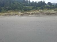
Mild , cloudy day. More people than usual, but still only nine. Natural summer sand deposition is well under way. The tide is low enough to allow access to the small marine garden near the hollow (about 50 feet deep horizontally) in the monolith in the group of monoliths near north end of Mile 23.
Conditions
Temperature: 57 F. Cloud Cover: Cloudy. Wind Velocity: Calm/Light. Wind Direction: S. Tide Level: 1.6 feet.
Human Activities
Number of people: 9. Walking or running: 4. Playing in sand: 4. Surfing: 1. Everyone is mellow, 2 kids playing in dunes , people sitting on driftwood ; another family with 2 little girls walking ,crossing Meyers Creek spooked a few gulls inadvertently. Solitary surfer nearly straight west of Henrys Rock (s. end mile 23).
Concerns
Apparent violations: atv track on sand near Meyers Cr..
Disturbances: Shorebirds moving in response to humans/dogs
Vehicles
Cars/trucks parking: 3. RVs/Buses parking: 1.
Notable Wildlife
gulls as usual at mouth of Meyers Cr. Ravens feeding on carcass of freshly killed gull; some turkey vultures far overhead.
Beached Birds
Total dead birds: 1. gull
Dead Fish or Invertebrates
scattering of a few mussel shells.
Driftline Content
Shells, Small rocks, Wood pieces. no litter ,
Man-made Modifications
none
Natural Changes
redeposition of beach sand is evident
Actions & Comments
no problems
Bob Harvey
CoastWatcher
All Mile 23 Reports
Mile 23
Pistol River SP north, south of Myers Creek
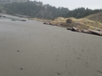
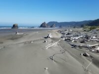
There was a lot of small plastic debris and natural tree debris along the tide line between Meyers Creek and a short distance south of the stacks.
Botermans
Mile 23
Pistol River SP north, south of Myers Creek
Steep newly cut foredunes and rocks more exposed because of winter waves scouring the beach.
Bob Harvey
Mile 23
Pistol River SP north, south of Myers Creek
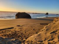
The cave in one of the monoliths was accessible.
Bob Harvey
Mile 23
Pistol River SP north, south of Myers Creek
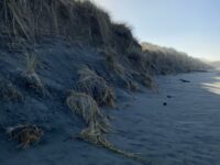
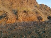
The tallest dunes (~10ft) are being eroded as they are each year.
Bob Harvey

Mile 23
Pistol River SP north, south of Myers Creek
Illegal ATV tracks recently made running from south to north and back again.
Bob Harvey
Mile 23
Pistol River SP north, south of Myers Creek
Parked here to walk Mile 22.
Lavenne22