Mile 23 Report
Pistol River SP north, south of Myers Creek
July 13, 2011
My apologies for shirking my March and June reports.
Report Details
My apologies for shirking my March and June reports.I spent the low May and June tides on the Clatsop beaches in search of the wiley razor clam. Yes I got 'em. I do recall having success razor clamming on Myers Creek beach in 1983, but a year later got but one. I've not tried again.The good news is no inappropriate changes occur on this beach. Summer dunes have replaced sand lost in winter, flowers bloom on the highway slopes, passing traffic stops for easy access to a gorgeous beach with scenic rock outcrops on and off-shore. South end has quantities of driftwood suitable for "fort" building.About 20 people and 4 dogs were using the beach in joyful ways. No human damage,no litter, no problems. Wildlife was a few gulls and crows.
Conditions
Temperature: 63 F. Cloud Cover: Sunny. Wind Velocity: Moderate. Wind Direction: N. Tide Level: 2.9 feet.
Human Activities
Number of people: 22. Number of dogs: 4. Walking or running: 21. Sitting: 1. small groups of people just enjoying fine sunny day
Concerns
Apparent violations: none.
Vehicles
Cars/trucks parking: 5. RVs/Buses parking: 2.
Notable Wildlife
2 dozen gulls6 crows
Driftline Content
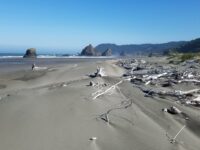
vey little debris
Man-made Modifications
no modification
Natural Changes
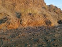
summer dunes both transverse and one longitudinal


Report Images
Bob Harvey
CoastWatcher
All Mile 23 Reports
Mile 23
Pistol River SP north, south of Myers Creek
There was a lot of small plastic debris and natural tree debris along the tide line between Meyers Creek and a short distance south of the stacks.
Botermans
Mile 23
Pistol River SP north, south of Myers Creek
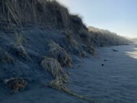
Steep newly cut foredunes and rocks more exposed because of winter waves scouring the beach.
Bob Harvey
Mile 23
Pistol River SP north, south of Myers Creek
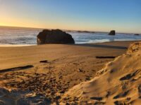
The cave in one of the monoliths was accessible.
Bob Harvey
Mile 23
Pistol River SP north, south of Myers Creek
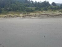
The tallest dunes (~10ft) are being eroded as they are each year.
Bob Harvey

Mile 23
Pistol River SP north, south of Myers Creek
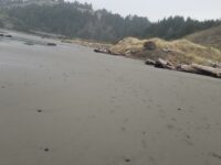
Illegal ATV tracks recently made running from south to north and back again.
Bob Harvey
Mile 23
Pistol River SP north, south of Myers Creek
Parked here to walk Mile 22.
Lavenne22