Mile 23 Report
Pistol River SP north, south of Myers Creek
February 2, 2014
I have been remiss.
Report Details
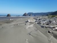
I have been remiss...last visit was July. Seasonal changes include loss of large summer sand ramp at southmost beach monolith; lengthy steep wavecut bank parallel to ocean with great quantities of large and small driftwood ,some of it (at least ) freed from interment in sand. At N end, Myers Creek's outlet has moved north against base of highway 101 riprap, around an on-beach monolith, then out to sea.About two hours before Your Reporter was there, a very high tide of 7.2 had crested.
Conditions
Temperature: 55 F. Cloud Cover: Sunny. Wind Velocity: Strong. Wind Direction: NW. Tide Level: 5.5 feet.
Human Activities
Number of people: 9. Walking or running: 3. Playing in surf: 4. Sitting: 2. premier beach behavior...4 kids playing in Myers Creek by 101 bridge, adults safely out of splashing range. Three smiling people walking northward. One brave wind surfer at mile 24 in heavy surf.
Concerns
Apparent violations: none.
Vehicles
Cars/trucks parking: 2.
Notable Wildlife
one seagull, which is notable by its loneliness. No other birds.
Driftline Content
Seaweeds and seagrass, Shells, Wood pieces. 2 kelp, i razor clam shell, and a few mussels
Man-made Modifications
none
Natural Changes
Seasonal steep winter cut banks with lots of driftwood, esp. at S end of mile 23


Report Images
Bob Harvey
CoastWatcher
All Mile 23 Reports
Mile 23
Pistol River SP north, south of Myers Creek
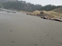
There was a lot of small plastic debris and natural tree debris along the tide line between Meyers Creek and a short distance south of the stacks.
Botermans
Mile 23
Pistol River SP north, south of Myers Creek
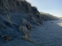
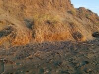
Steep newly cut foredunes and rocks more exposed because of winter waves scouring the beach.
Bob Harvey
Mile 23
Pistol River SP north, south of Myers Creek
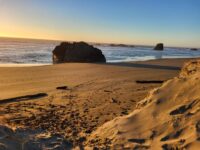
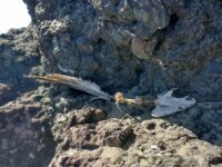
The cave in one of the monoliths was accessible.
Bob Harvey
Mile 23
Pistol River SP north, south of Myers Creek
The tallest dunes (~10ft) are being eroded as they are each year.
Bob Harvey

Mile 23
Pistol River SP north, south of Myers Creek
Illegal ATV tracks recently made running from south to north and back again.
Bob Harvey
Mile 23
Pistol River SP north, south of Myers Creek
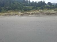
Parked here to walk Mile 22.
Lavenne22