Resources > News
King Tides and Community Science
The Oregon King Tides Project is now in its 14th year. We’ve already experienced the first of the four high-tide sequences. The remaining extreme high tides will be the focus of the 2023-2024 edition of the project:
- December 13-15, 2023
- January 11-13
- February 8-10, 2024
Volunteers from last year’s community science effort, organized by CoastWatch and the Oregon Coastal Management Program, contributed 241 photos and four videos from along the Oregon coast.
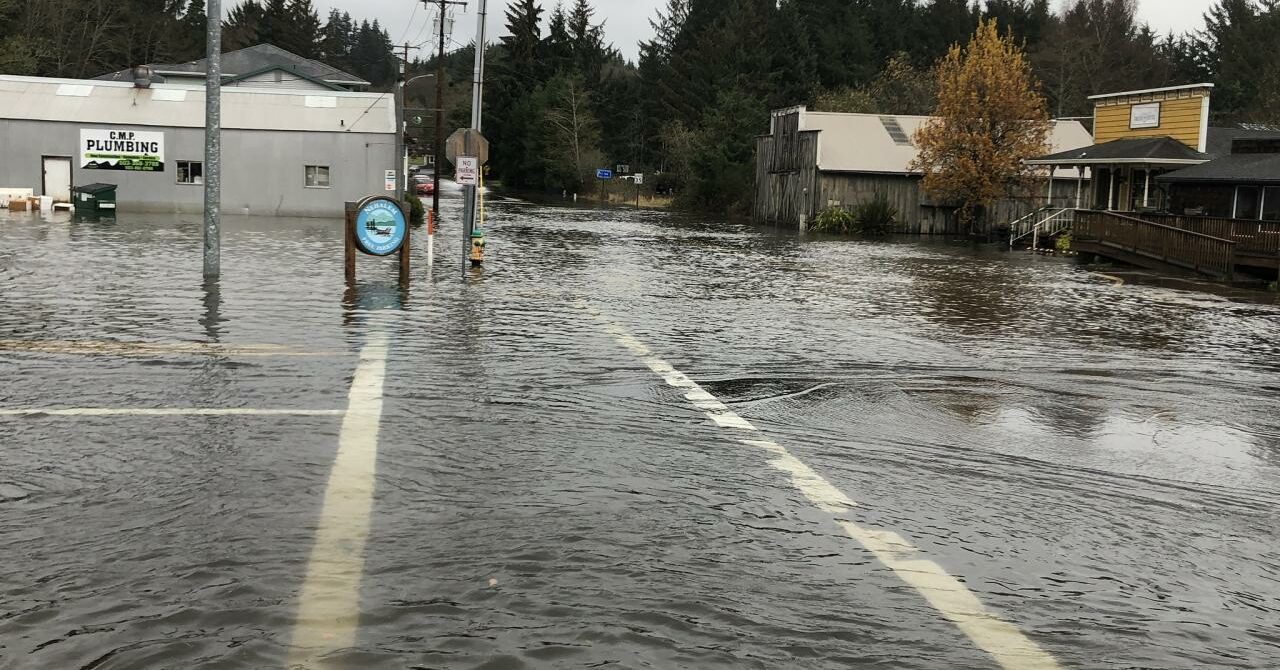
Through the Oregon King Tides Project, volunteers take photographs depicting the highest reach of the highest tides of the year, documenting current vulnerabilities to flooding while providing a preview of what could be typical high tides with sea level rise and global warming. Each winter, the three highest tide sequences become the focus of this effort. But there are things that participants can do in the interim. The project places emphasis on comparison shots–photos taken from the same spot at the high point of a comparatively normal high tide, to be contrasted with the same view at the high point of a king tide. Volunteer photographers are encouraged to start finding good locations (or ones they’ve used before) and taking photos during typical tide sequences, anticipating the comparisons to be made with this year’s coming peak tides. (Note that the comparison is high tide to high tide, not low tide to high tide.)
The photos from the past winter can be seen on the project’s special Flickr site, along with those from past years. On the Flickr site, you can also see aerial images of king tides and how they affect the landscape, taken by photographers Rena Olson and Alex Derr for Oregon Shores, and Briana Goodwin for Surfrider. They were provided with Lighthawk flights to photograph the effects of the king tide on the Coquille, Siuslaw, and Alsea drainages from the air, and we are sharing those photos as well.
For the past decade-plus, CoastWatch has collaborated with the state’s Coastal Management Program (a branch of the Department of Land Conservation and Development) to sponsor Oregon’s contribution to this international citizen science initiative. (The project originated in Australia, where these highest tides of the year are known as “king tides,” so this colloquial term is now used for projects around the world.) We helped to pioneer the concept; the Oregon project debuted in the same year as the international effort. Through the King Tides Project, photographers trace the reach of the year’s highest tides, showing the ocean’s intersection with human-built infrastructure (roads, seawalls, trails, bridges) and natural features such as cliffs and wetlands. Anyone capable of wielding a camera can participate.
To see the work of the dozens of volunteer photographers who have contributed to the work over the years, see this special Flickr site.
Documenting the highest annual reach of the tides tells us something about areas of the natural and built environments that are subject to erosion and flooding now. It tells us even more about what to expect as the sea level rises. Photographs of any tidally affected area—outer shores, estuary, or lower river—are relevant. The ideal would be to document the high tide point everywhere on the coast. However, photos of spots where the extreme tidal reach is particularly apparent, inundating built or natural features, are most striking and clearly depict the future effects of rising sea levels.
For more information on the project and how to participate and post photos, see the project’s website: http://www.oregonkingtides.net/. Participants can post photographs online through this site. Be prepared to include the date, description, and direction of the photo. An interactive map will assist photographers in determining the exact latitude and longitude at which a photo was taken. Photos can also be posted to social media (Instagram, Facebook, or Twitter) and tagged #orkingtides.
For information about the project and how to get involved, contact Jesse Jones.
Curious about community science? Consider adopting a CoastWatch Mile and joining a project!