Mile 287 Report
Bayocean Peninsula north of Bayocean site 2
December 5, 2021
The highest of December's king tides coincided with a cool, calm, dry, pleasant day on Mile 287.
Report Details
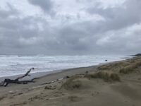
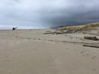
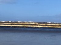
The highest of December's king tides coincided with a cool, calm, dry, pleasant day on Mile 287. I did not witness the dramatically high water levels I had expected with the king tide, however. While there was very little beach between the high water tideline and the foredune, the water still was not high enough to reach the foredune (see photo). There was evidence that previous high tides had recently overtopped the foredune in a couple of the low-lying sections at the northern end of the mile, but there was no obvious erosion of the dune anywhere on the mile. Of note, there has been considerable sand accretion since my last visit; the driftwood root ball I have been using as a marker of sand depth was almost completely buried.There were a number of folks and their dogs enjoying the beach and one couple picnicking in the dunes. There was very little debris visible on the beach and most of that was related to fishing and crabbing (bobbers, crab bait containers, bouys, lines, etc.) - and only one plastic bottle. All that needed to be removed was one medium sized bag of trash, which was less than usual.
Conditions
Temperature: 42 F. Cloud Cover: Cloudy. Wind Velocity: Calm/Light. Wind Direction: SW. Tide Level: 9.4 feet.
Human Activities
Number of people: 14. Number of dogs: 6. Walking or running: 12. Sitting: 2.
Vehicles
Driftline Content
Small rocks, Seaweeds and seagrass, Shells, Animal casings (e.g., crab, shrimp molt), Wood pieces, Land-based debris (picnics, etc.), Styrofoam, Ocean-based debris (from fishing boats, ship trash, etc.).
Man-made Modifications
Dune modification/removal. The private property owner whose lot adjoins mile 287 at the mid-point of the mile has carved out three new level tent sites in the grass at the top of the foredune. Counting the single tent site that had been previously established, there are now four tent sites from which dune grass and other vegetation have been removed. Pathways to and between the four tent sites have also been cleared.
Natural Changes
Evidence of wave overtopping.

Report Images
All Mile 287 Reports
Mile 287
Bayocean Peninsula north of Bayocean site 2
The cloudy marine layer that was present when we first arrived eventually burned off, providing us with a pleasant but breezy sunny afternoon for our visit. 1) We encountered an intact hull of a fiberglass boat on the mid-section of the mile; photos and location information was provided to the State Park Ranger so it could be retrieved from the beach. 2) There had been a massive influx of velella velella (by-the-wind sailors) washed ashore several days before our visit. 3) Given the number of folks in the parking area when we arrived, we had expected to see more folks on mile 287 but encountered just a typical number of visitors. 4) There was more detritus on the beach than we've seen in recent previous visits.
C NELSON
Mile 287
Bayocean Peninsula north of Bayocean site 2
A lovely, busy day at the beach on this sunny, late summer SOLVE clean up day.
C Nelson
Mile 287
Bayocean Peninsula north of Bayocean site 2
An absolutely gorgeous summer day -- warm, clear, sunny, light breeze.
C Nelson
Mile 287
Bayocean Peninsula north of Bayocean site 2
We were disappointed that the SOLVE beach clean-ups have not been re-initiated following the pandemic, so decided to do our own.
C Nelson
Mile 287
Bayocean Peninsula north of Bayocean site 2
The primary purpose of this visit was to observe the impact of the last of this winters king tides.
C Nelson
Mile 287
Bayocean Peninsula north of Bayocean site 2
Remarkably clear smooth sand with small amount of driftwood pushed high up the beach.
JuliaH
Mile 287
Bayocean Peninsula north of Bayocean site 2
A pleasant December afternoon.
C Nelson
Mile 287
Bayocean Peninsula north of Bayocean site 2
A pleasant, partly cloudy spring day.
C Nelson

