Mile 190 Report
Captain Cook Pt, Cooks Chasm, Cape Perpetua SRA, Cape Cr
February 10, 2019
I normally don't report on Mile 190 but since I've been a volunteer naturalist/interpretive ranger at Cape Perpetua since 2008, I can report on those things that have been changing over the years.
Report Details
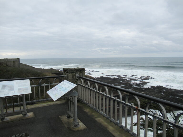
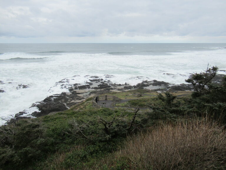
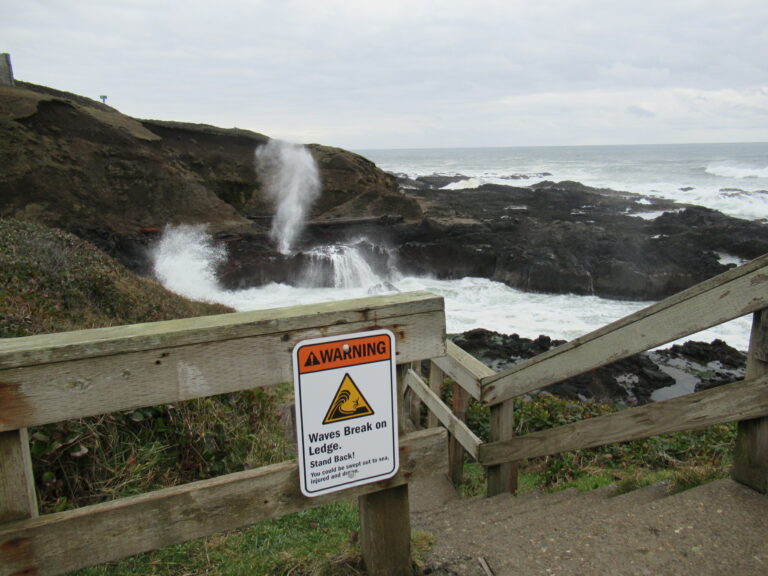
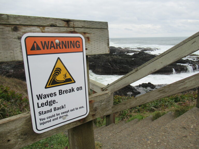
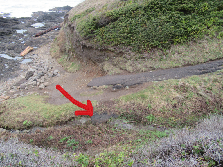
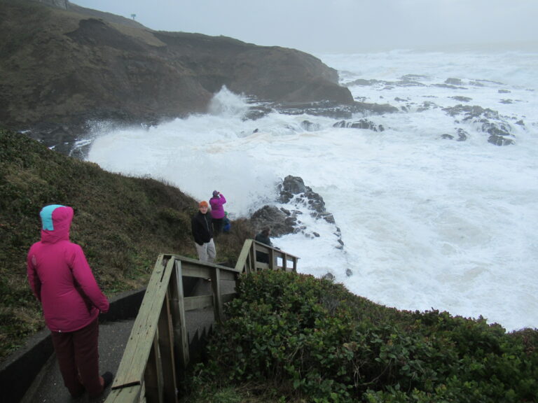
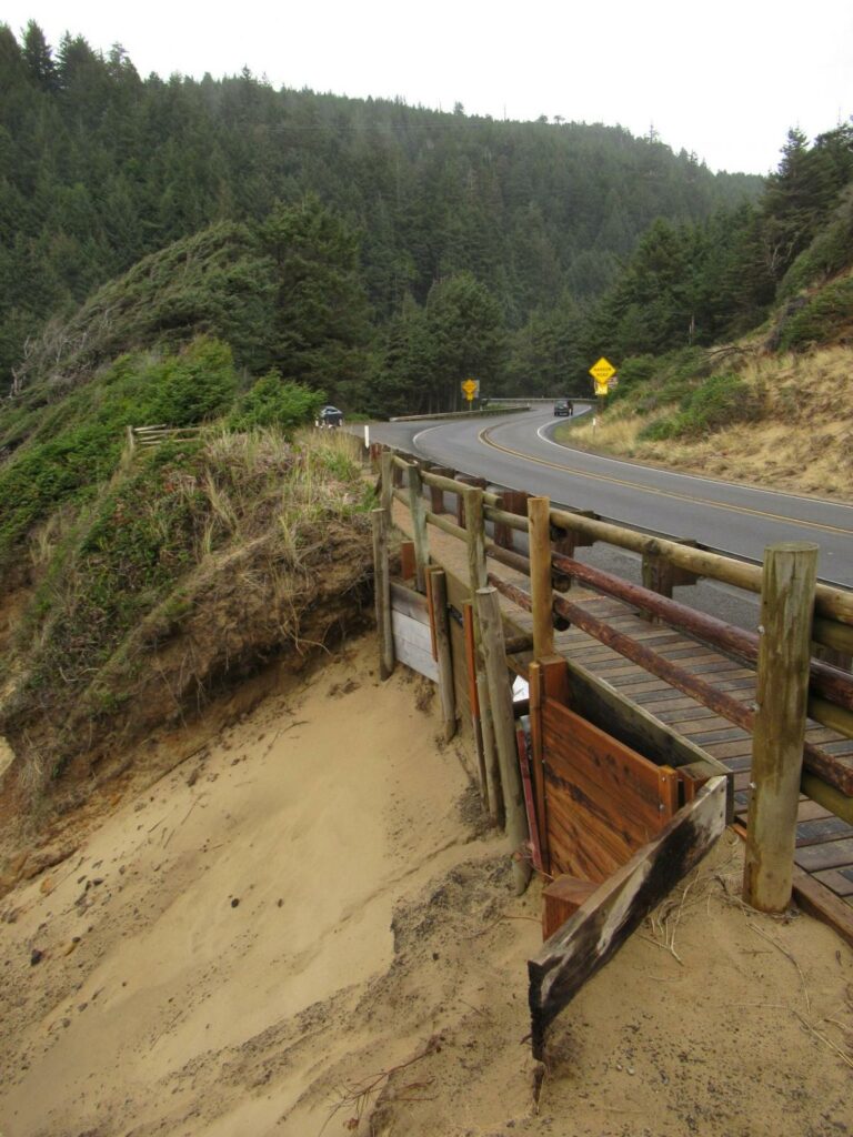
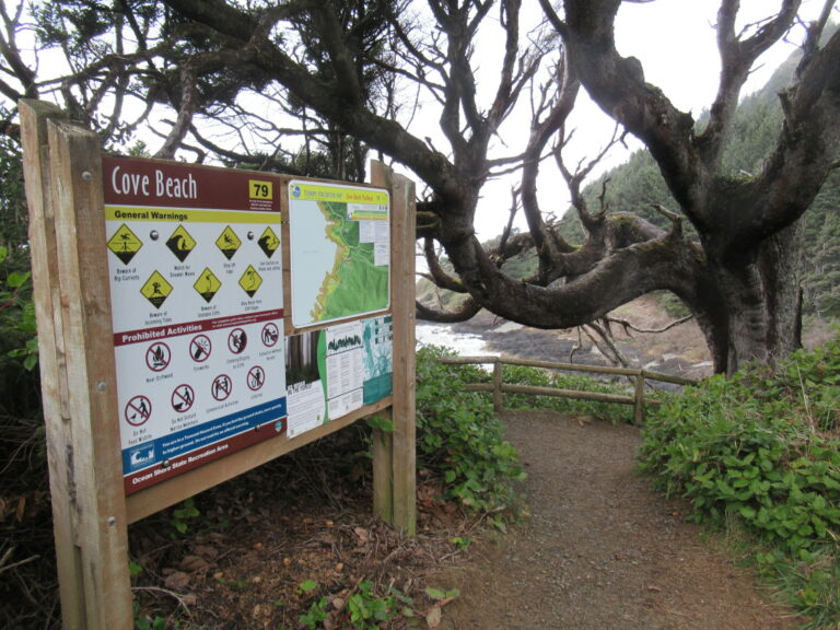
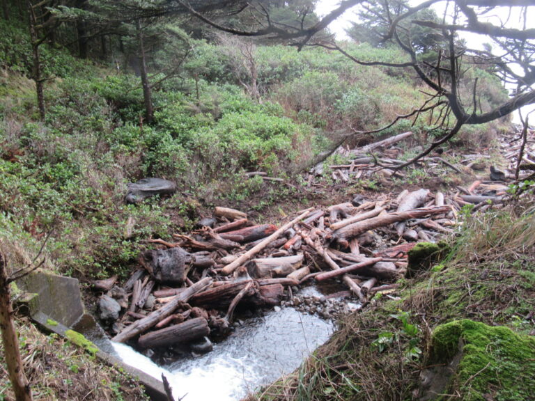
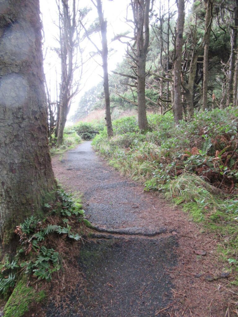
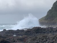
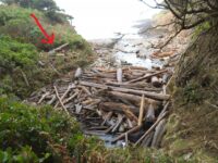
I normally don't report on Mile 190 but since I've been a volunteer naturalist/interpretive ranger at Cape Perpetua since 2008, I can report on those things that have been changing over the years. I walk the Captain Cook , Cape Cove, and Restless Waters trails every Sunday. Since the south half of Mile 190 is not accessible to casual pedestrian traffic due to a rough and jagged volcanic rock shoreline with no trails of any sort, this report will cover just the paved trails and accessible north half of Mile 190.Easily the most commonly asked question we answer is "Where is Thor's Well?" Signs were installed several years ago, but most were quickly stolen and have not been replaced. Previously known in the 1980s as the "Toilet Bowl", this feature has a huge Internet-based presence and it seems everyone just has to walk out to it for photography with everything from el cheapo point-and-shoots, smart phones, to super high-end cameras. Since the entire rocky shoreline is technically a state park, its all public property. The latest trend is to march out there, stand at the edge with your back to the ocean and take your "selfie" with the waves crashing ashore behind you. We frequently see people get knocked down by waves, causing lots of "rock burn", the occasional broken bone(s), ruined electronics, and a fatality/drowning two winters ago. It's perfectly safe to go out there at low tide, but approaching Thor's Well near high tide or with large swells crashing ashore is hazardous to your health and potentially fatal.Since the drowning, we have replaced all of the way-too-wordy "sneaker wave" signs with a simple graphic warning sign (photo). We positioned the signage so that no matter how you approach Thor's Well, you must walk by two warning signs. The term "sneaker wave" does not translate well into Chinese or Texan, so we removed all references to that term and instead use internationally recognized symbology indicating "Danger!". We have since observed a definite improvement in visitor behavior and concern for their own safety, although there will always be that 2% of clueless risk-takers we refer to as "Darwin Award Candidates". They get knocked down frequently.Oregon state parks have recently installed general warning, location identifier, and beach safety signs at Cape Perpetua. New tsunami inundation and safety maps have also been installed at all highway trail access points (photo).The recent "King" tides have swamped the Spouting Horn lower observation platform and damaged the stub trail leading to the tide pools (photos). A collapsing sand bank undermined the Cape Cove trail alongside Hwy 101, requiring the Forest Service to build a temporary bridge over the collapsed section (photo). The last set of King tides washed away the base of the slide, which will likely re-activate the bank failure. ODOT has been notified of potential undermining of Hwy 101.The recent King tides also re-arranged the driftwood log pile at the base of Cape Creek, throwing huge stumps and logs high into the salal - never seen that before! (photo).The Forest Service has approved a complete re-building and re-paving of the Cape Cove and Restless Waters trails this year. The 1960s vintage asphalt is badly broken and buckled by tree roots, pavement edges are crumbling, and several pedestrian injuries have recently occurred here due to the uneven and broken surfaces (photo). Mile 190 ends at the scenic bench out on the point. Mile 191 continues north past Devil's Churn and around the point of Cape Perpetua but there is no pedestrian trail on the north side of the "Churn". I've scrambled around the point in the past, but it's rough, jagged basalt rock requiring serious scrambling and careful foot placement on slippery, crumbly rocks. Due to cliffs and a large sea cave on the NW side of the Cape, it is impossible to continue north towards Yachats and to the north end of Mile 191.FYI - The Forest Service will also be replacing all of the wood structure (roof, beams, posts, and shingles) of the West Stone Shelter, at the top of Cape Perpetua this September. This will structured as a "Passport In Time" project, with a professional restoration team assisted by volunteers. The volunteer information should be posted soon.
Conditions
Temperature: 35 F. Cloud Cover: Cloudy. Wind Velocity: Calm/Light. Wind Direction: SE.
Human Activities
Number of people: 5. Photography: 2.
Vehicles
Cars/trucks parking: 6.
Notable Wildlife
Several mature bald eagles, one river otter, song sparrows, chestnut-backed chickadees, winter wrens
Driftline Content
Shells.
Natural Changes
Evidence of wave overtopping.
Report Images
oldMGguy
CoastWatcher
All Mile 190 Reports

Mile 190
Captain Cook Pt, Cooks Chasm, Cape Perpetua SRA, Cape Cr
A beautiful day at the coast at Cape Perpetua, very strong winds, tide remains high 2 hours following high tide, Devils Churn full of water, foam whipped to consistency of whipped cream.
LyndaC

Mile 190
Captain Cook Pt, Cooks Chasm, Cape Perpetua SRA, Cape Cr
I normally don't report on Mile 190 but since I've been a volunteer naturalist/interpretive ranger at Cape Perpetua since 2008, I can report on those things that have been changing over the years.
oldMGguy
Mile 190
Captain Cook Pt, Cooks Chasm, Cape Perpetua SRA, Cape Cr
Visited the ocean December 26th, a damp, showery day with small number of visitors.
LyndaC
Mile 190
Captain Cook Pt, Cooks Chasm, Cape Perpetua SRA, Cape Cr
Beautiful day at the beach, large number of people enjoying nature.
LyndaC
Mile 190
Captain Cook Pt, Cooks Chasm, Cape Perpetua SRA, Cape Cr
I have been a volunteer naturalist ranger, trail crew, trash-picker-upper at the Cape Perpetua Scenic Area since 2008.
oldMGguy
Mile 190
Captain Cook Pt, Cooks Chasm, Cape Perpetua SRA, Cape Cr
A beautiful July day, the coast being enjoyed by a large number of people, Devil's Churn parking lot filled.
LyndaC
Mile 190
Captain Cook Pt, Cooks Chasm, Cape Perpetua SRA, Cape Cr
a beautiful day, and a large number of visitors
LyndaC
Mile 190
Captain Cook Pt, Cooks Chasm, Cape Perpetua SRA, Cape Cr
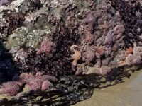
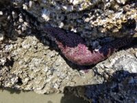
The rock walls appear to have been scoured of small blue mussels and the only sea star noted was in a depression at the top of a rock at the western edge of the beach, which also appeared to be part of a healthy community with anemone.
LyndaC