All Mile 58 Reports
Mile 58
Floras Lake SP, between Castle Rock and Blacklock Pt
Good walk to Blacklock Point today, a bit cool especially at the point, fog and blowing NW moderate winds kept you on the south side of point.
Bob Ivey

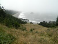
Mile 58
Floras Lake SP, between Castle Rock and Blacklock Pt
Walked from Cape Blanco Airport trail to Blacklock Point, down the south side and down the beach to mouth of Sixes River.
Bob Ivey