Commemorative Map
Produced by Oregon Shores in collaboration with Raven Maps of Medford, this is not your ordinary fold-it-up-and-stuff-it-in-the-glove-box road map. Printed in high resolution and vibrant colors on glossy paper, these are archival giclée prints – fine art quality maps suitable (and recommended!) for framing.
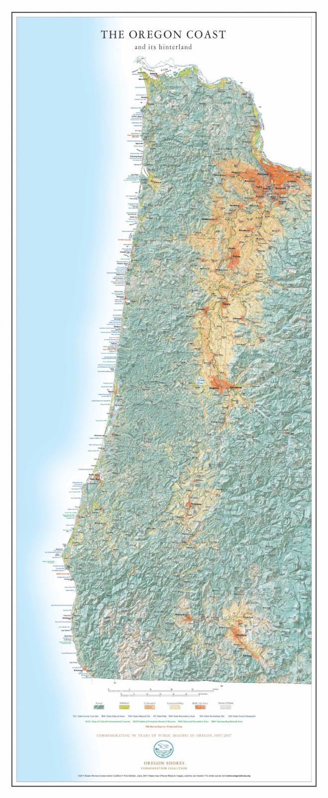
Starting with a land cover map of all of Oregon, we focused on the coast region and added:
- All coastal Oregon State Park lands (Parks, Natural Areas, Scenic Corridors, Scenic Viewpoints, Recreation Areas)
- Marine Reserves and associated Marine Protected Areas
- Federal Wildlife Refuges and other selected federal conservation lands (Outstanding Natural Areas, National Recreation Areas, National Estuarine Research Reserve, and Areas of Critical Environmental Concern).
In addition to representing topography with classic shaded relief, the map uses specific colors to indicate the major types of land cover in the state: forest, wetland, built/developed areas, cultivated land, and grassland/hay.
The maps are printed at 22 x 50 inches, including 1.75-inch margins to allow for framing. This size will fit on almost any door or will look beautiful on your wall — in addition to providing a handy, detailed reference to the geography and key public sites on the Oregon coast. Larger sizes can be printed upon request. Get one for your home or office or a friend!
Interested in bulk orders or larger sizes? Write to webmaster@oregonshores.org.