Resources > News
CoastWatch Organizes Citizen Science Engagement

CoastWatch and partner organizations organize a range of citizen and community science projects throughout the coastal region. This summer, CoastWatch volunteers are actively involved in projects from Fort Stevens in Clatsop County to Rocky Point in Curry County.
Involving the public in data-gathering and scientific research on the Oregon coast can assist both local communities and state and federal agencies in understanding and managing resources. It can lead to important ecological observations. It also doubles as science education, and often makes for some wild discoveries. For CoastWatch volunteers, engaging in these projects provides an opportunity for in-depth assessment and investigation on their adopted miles. CoastWatch offers these opportunities by coordinating among volunteers and scientists and researchers from colleges, non-profits and resource agencies. Each project is a form of stewardship in which non-scientists play a valuable role in gathering information that contributes to research and management on the Oregon coast.
One key project is the marine debris survey CoastWatch leads. This spring, CoastWatch Volunteer Coordinator Jesse Jones set up or recharged 14 sites for marine debris monitoring including Taft, Sunset Beach, Buckley Creek, Rocky Point, Ocean Beach, Neskowin, Battle Rock and Otter Rock Marine Reserve. Our partner in this project is NOAA (the National Oceanic and Atmospheric Administration). The impetus to increase these surveys came from a winter of increased marine debris on our shores and the public wanting to help solve the problem. Volunteers have found that contributing to collecting data once a month to help NOAA discover trends is a valuable use of their time. Some have found that it helps to reduce the anxiety that comes with feeling hopeless in the face of so much plastic pollution.
Training is available for this survey year-round. Contact Jesse Jones if you’d like to start your own site, or join another one in your community. A survey site is 100 meters long and goes from the back of the beach to the edge of the water.

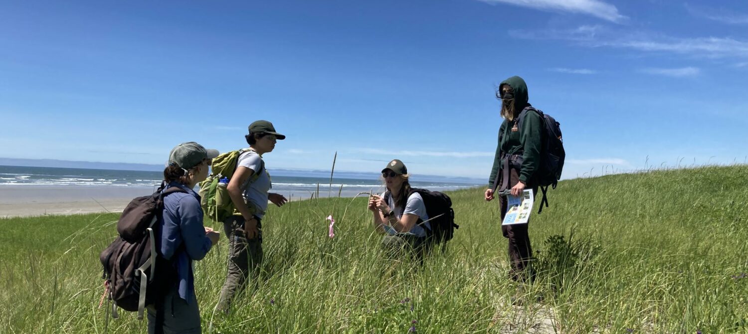
July is peak time to look for the recently discovered hybrid beachgrass on the northern Oregon coast, between Fort Stevens and Bob Straub state parks. CoastWatch sponsors in-the-field trainings to identify and map this grass, assisting researchers at Oregon State University. Identification involves walking in grass-covered dunes, pulling back the blade from the stem, checking the length of its ligule, taking a photo with your phone and adding it to the Hybrid Beach Grass Mapping in the Pacific Northwest, a project on iNaturalist. The map below shows priority sites. Risa Askerooth, an OSU graduate student who is our contact for this project, says that she knows the hybrid is in the Gearhart and Seaside areas, but she hasn’t been able to locate it. Can you find it? Contact Jesse if you’d like to get tips on how to identify this grass and how to join iNaturalist, the tool used to document your findings. Let us know if you’d like to join in the hunt.

Snowy plovers and black oystercatchers are particularly vulnerable this time of year. Portland Audubon is seeking volunteers to monitor chicks when they hatch, and to help identify new nests. Some places on the coast need more help than others, and CoastWatch can help you make the connections and get the training you need.

Sea star populations are in still need of volunteer eyes and cameras. Sea Star Wasting Syndrome hasn’t left our tidepools yet and affected stars are still seen. Observations can take place year-round, but the summer low tides are best for discovering and noticing the health of these keystone species. Our partners at MARINe (Multi-Agency Rocky Intertidal Network) are grateful for volunteers who send in observation forms. If you’d like to learn about how to identify a diseased star in the wild, please consider joining upcoming CoastWatch volunteer orientations that focus on rocky habitats. The next scheduled takes place will be July 30 at Indian Beach.

Identifying a bird by only its beak and one of its wings, documenting the reach of tides with photos and counting and measuring the size of sea stars on a giant boulder are all ways of learning about our ocean world. Documenting what we observe on the shore is important to making decisions in our local communities and beyond. In Oregon and elsewhere, suggestions for policy may come from data collected from citizen and community science projects. Researchers and scientists are in need of trained eyes in the field, gathering information to help answer important questions, the answers to which may increase the health and safety of our communities.
CoastWatch trains volunteers in field protocols, and people with such training naturally become increasingly observant of the coastal world surrounding them. They become interpreters of nature to everyone around them, sharing their knowledge of beaches dunes, tides and tidepools, wildlife, and changes in our shoreline environment, both natural and human-driven. For CoastWatchers, the adopted mile becomes the data collection site for everything from spring and summer tidepool counts of sea stars to monthly beached bird identifications, winter king tides and summer dune grasses. But there is plenty of room in these surveys for non-CoastWatchers as well.
To learn more or join one of these projects, contact Jesse Jones, CoastWatch’s volunteer coordinator, at jesse@oregonshores.org.