Mile 220 Report
Yaquina Head north, Schooner Creek south
August 16, 2018
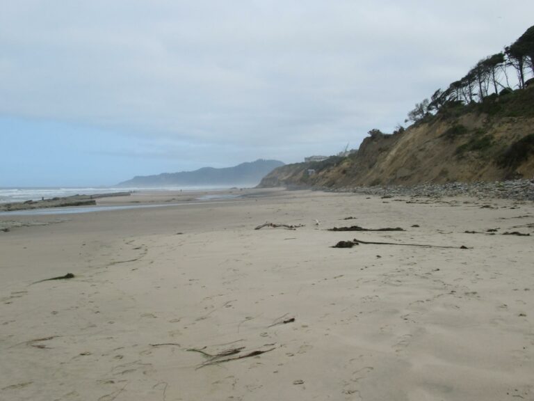
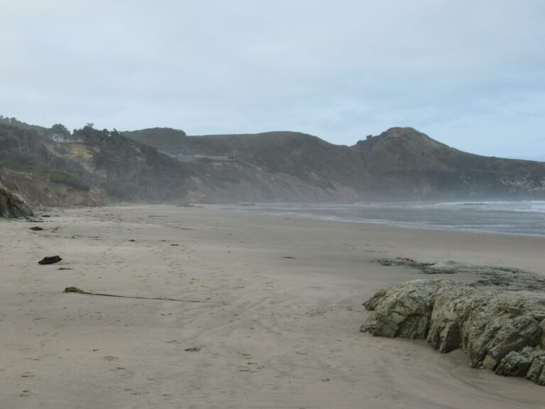
It was a pleasure to walk the mile as the sand has filled in the cobble near NW 68th Street and rock sections near Yaquina head.
Report Details
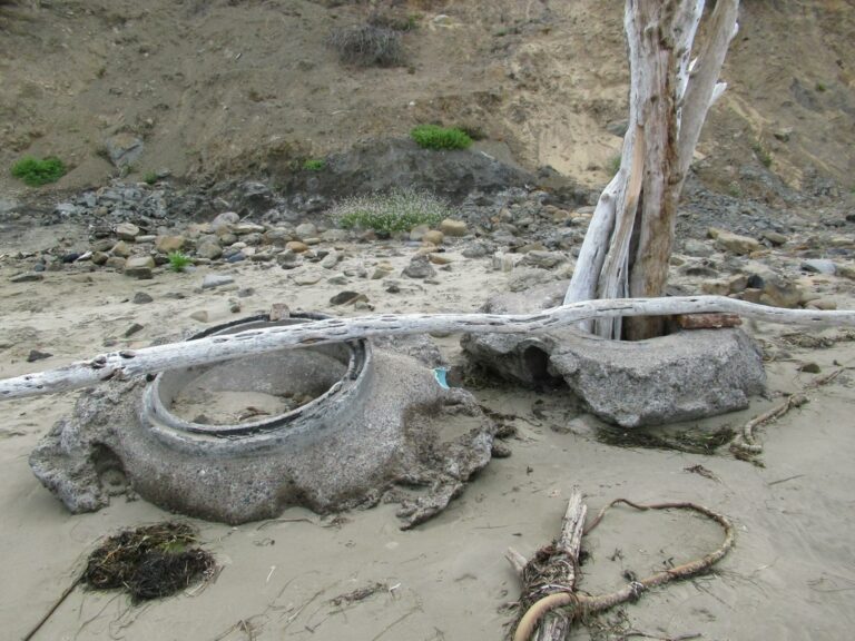
It was a pleasure to walk the mile as the sand has filled in the cobble near NW 68th Street and rock sections near Yaquina head.I have a new hiking Garmin -- there are several changes in positioning. First, the landslide at Yaquina Head has caused me to move to another spot. Second, since there are now two concrete sections on the beach, I have moved the co-ordinates to the concrete on the beach (formerly was with second pipe at equivalent of NW 62 Street)
Conditions
Temperature: 65 F. Wind Velocity: Calm/Light. Wind Direction: NW. Tide Level: 1.0 feet.
Human Activities
Number of people: 21. Number of dogs: 1. Walking or running: 8. Tidepooling: 13. I usually do the beach earlier in morning--so larger number of people. The car was at NW 68th Street access. Several families headed to the south end of mile into sand filled tidepool area.
Vehicles
Cars/trucks parking: 1.
Notable Wildlife
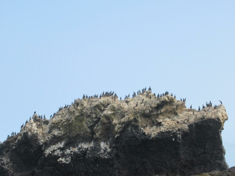
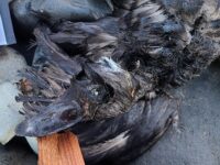
I could easily count several hundred birds--Yaquina Head is a bird breeding area.
Beached Birds
There were no signs of the 700-1,000 gallon diesel oil spill in Yaquina River (about 5 miles to South) which happened on August 14.
Driftline Content
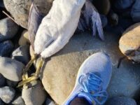
Seaweeds and seagrass, Shells, Animal casings (e.g., crab, shrimp molt), Marine debris (plastic, styrofoam, etc. washing in from the sea). I really checked the drift line since there was a 700-1,000 gallon diesel fuel spill in Yaquina Bay (roughly 5 miles south) two days ago. I saw no oil. The wrack line was kelp, shells, some dungeness castings--but also many body parts (birds feeding). The beach was basically free of plastic--just a few small "mini" pieces toward the southern part of the mile toward Yaquina Head.
New Development
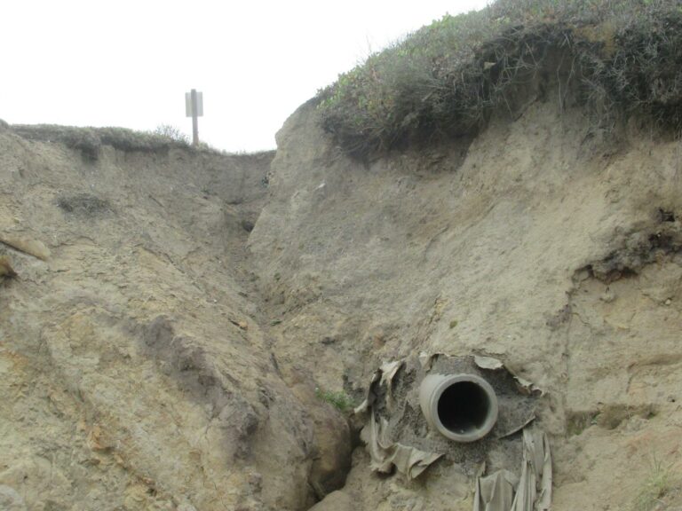
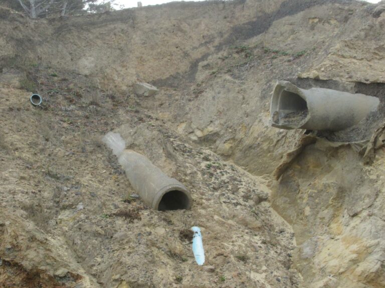
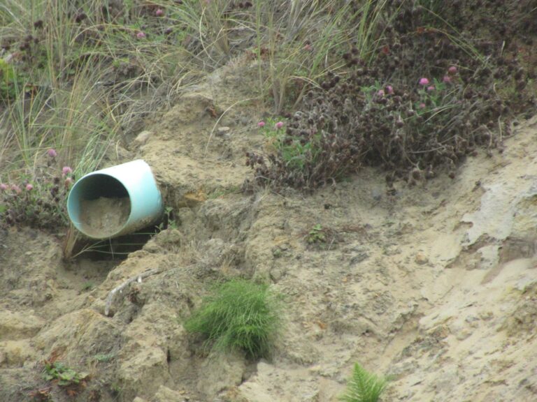
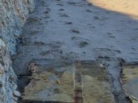
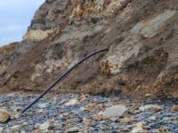
Drainage pipes. Drainage pipes--there is now a second concrete section on the beach and someone filled it with fairly large pieces of driftwood set on edge.
Natural Changes
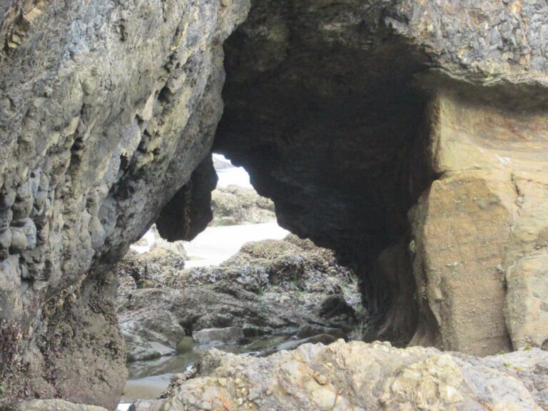
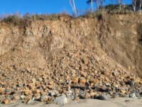
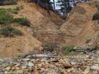
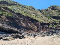
Landslides/major boulder falls. There was a landslide at the point where I took the "keyhole" pictures. I moved from the point about 20 feet and have a new Garmin GPS position.
Report Images
DKPowell
CoastWatcher
All Mile 220 Reports
Mile 220
Yaquina Head north, Schooner Creek south
Beautiful sunny but windy day.
Jill Marks
Mile 220
Yaquina Head north, Schooner Creek south
A large amount of debris, 7 large wood/foam panels and lots of pieces of all sizes of foam.
Hillsideshack
Mile 220
Yaquina Head north, Schooner Creek south
Schooner South's cliffs/bluffs continue to erode.
Hillsideshack
Mile 220
Yaquina Head north, Schooner Creek south
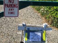
New sign up at the Schooner South beach access off 68th St warning of Contaminated waters.
Hillsideshack
Mile 220
Yaquina Head north, Schooner Creek south
No clouds in the sky, what a day on 220!
Hillsideshack
Mile 220
Yaquina Head north, Schooner Creek south
Started off chilly but the sun was shining and it was a gorgeous day on 220!
Hillsideshack
Mile 220
Yaquina Head north, Schooner Creek south
Continued changes on 220 due to the rains, high tides and normal loss of sand in winter.
Hillsideshack
Mile 220
Yaquina Head north, Schooner Creek south
Including photos of a black plastic pipe sticking out of Mile 220 bluff and odd milky fluid coming out of bluff and over rocks.
Hillsideshack